ZCTA Map Search
Let visitors click a ZIP code boundary drawn on a map and see the active listings inside it — boundaries come from Census ZCTA data, listings come from your IDX Broker MLS feed.
Use this appInteractive ZIP Code Boundaries on a Map
The ZCTA Map Search widget displays U.S. Census ZIP Code Tabulation Area (ZCTA) boundaries on an interactive map embedded in your website. Visitors can click any highlighted ZIP code zone to instantly browse the active MLS listings within that area — no manual searching required.
You select which ZIP codes to feature from the admin panel, preview their boundaries on a live map, and optionally assign custom labels (e.g. "Downtown", "Lakefront") to make the widget more intuitive for your visitors.
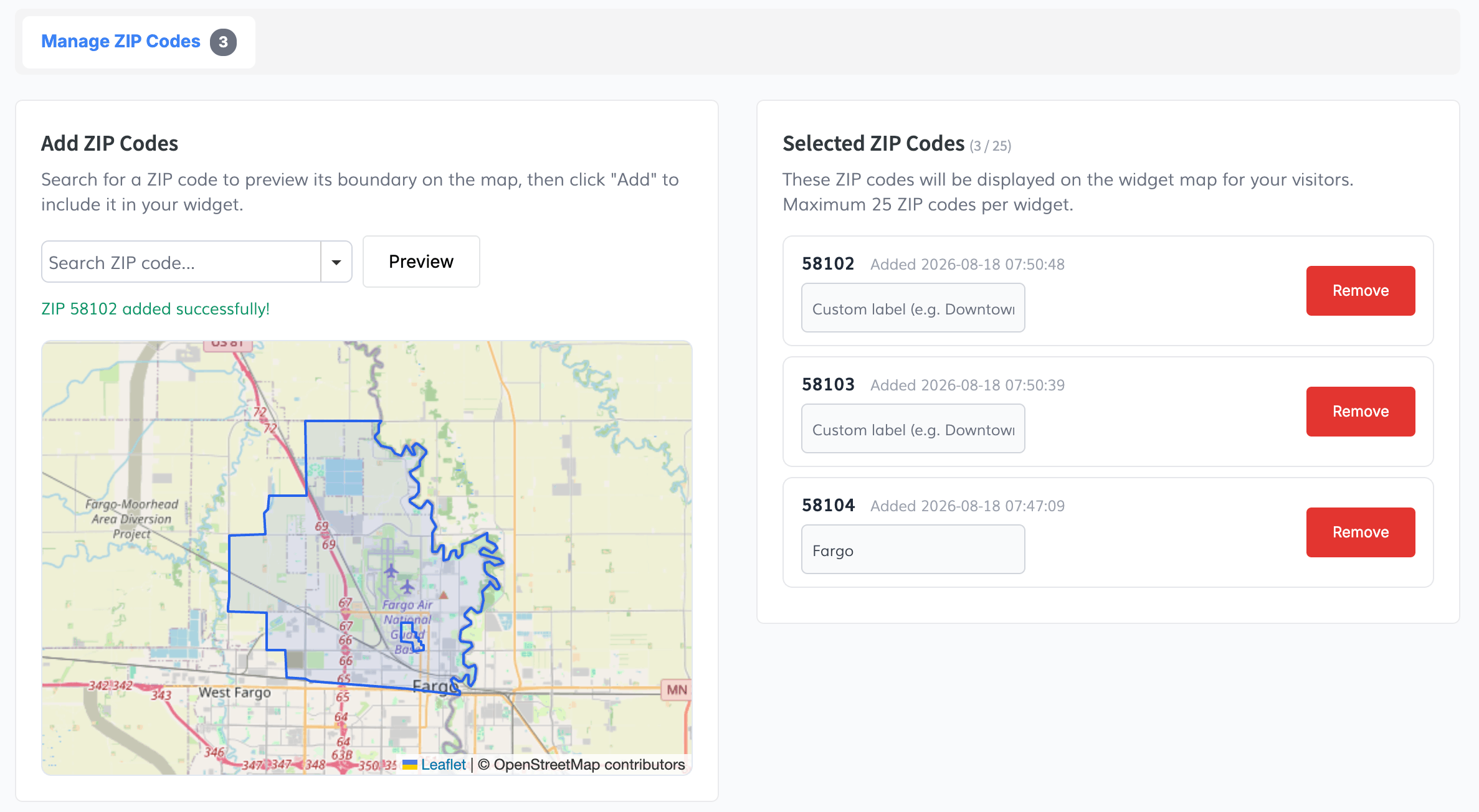
Search, preview, and add ZIP codes
Search for any ZIP code using the autosuggest input. When you select one, its ZCTA boundary is drawn on a preview map so you can verify the area before adding it. Click "Add" to include it in your widget — up to 25 ZIP codes per widget.
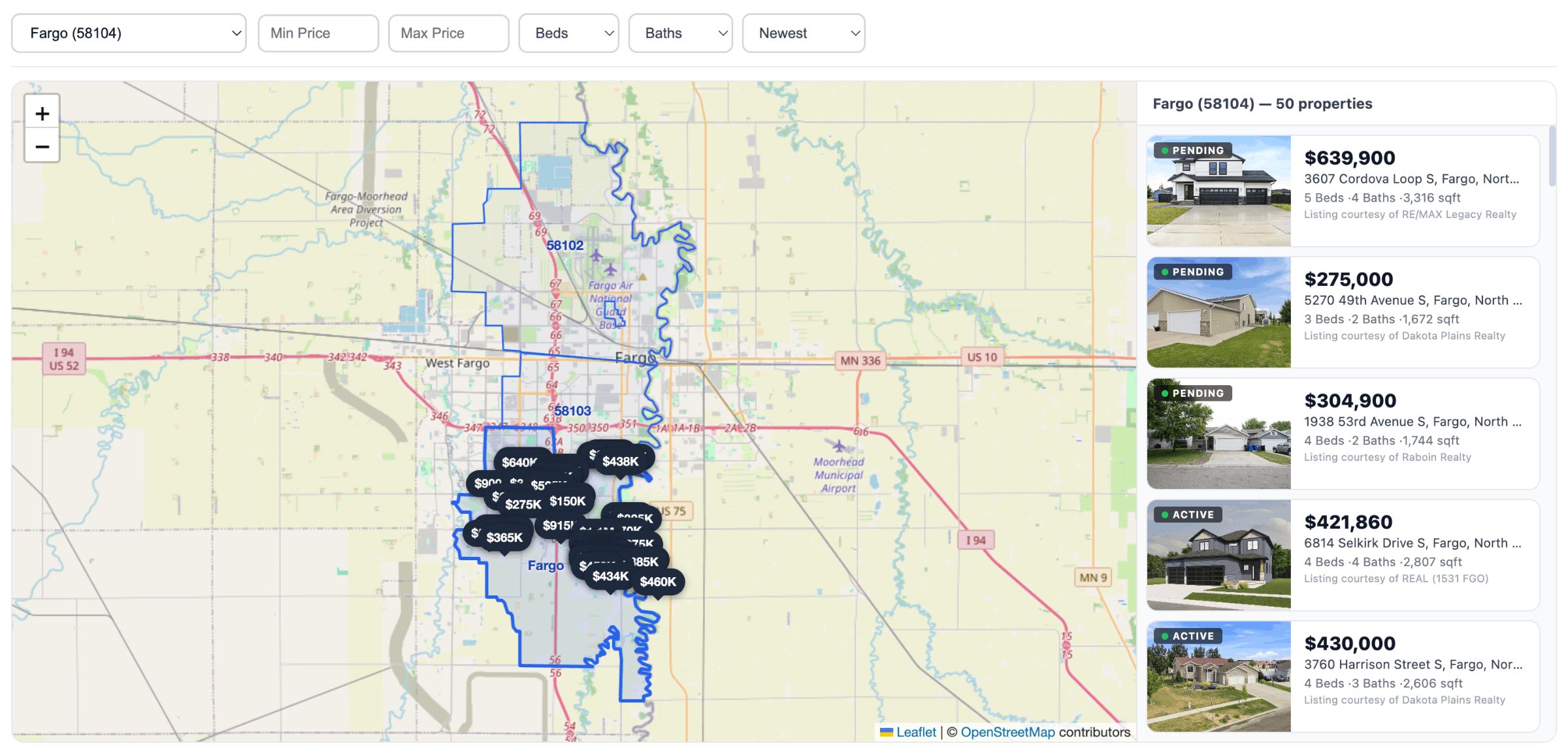
Give each ZIP code a friendly name
Assign custom labels like "Downtown", "Midtown", or "Beachside" to any ZIP code you add. Labels make the map more meaningful for visitors who may not know ZIP codes by number. You can update or remove labels at any time.
One script tag, ready for any website
Once you've added at least one ZIP code, a ready-to-use embed code appears. Copy the single script tag and paste it into any page on your website. The widget renders an interactive map with all of your selected ZCTA boundaries — visitors simply click a zone to see listings.
United States only
This widget uses U.S. Census ZCTA boundary data and is only available for clients with properties in the United States. ZIP code boundaries are sourced from official Census ZCTA shapefiles.